
About Osmaniye
Today Osmaniye is a province in Turkey, the centre of a rich agricultural region well watered by the Ceyhan river system and well known (GI) for growing peanuts. There are plenty of forests too and much of the surrounding countryside is very attractive. The province is situated in Çukurova, a geographical, economical and cultural region.
Area 3,767 km². Population of Osmaniye city: 219,339. Osmaniye Province: 512,804 (2014). Osmaniye is at an elevation of 125 meters (410.1 feet). 25 km from the Mediterranean coast.
Osmaniye has been inhabited for thousands of years. The history of these places goes back to the earliest known periods. It has been the scene of the lives of states such as Hittite, Assyrian, Persian, Greek, Roman, Byzantine and some tribes since the first ages.
About Osmaniye
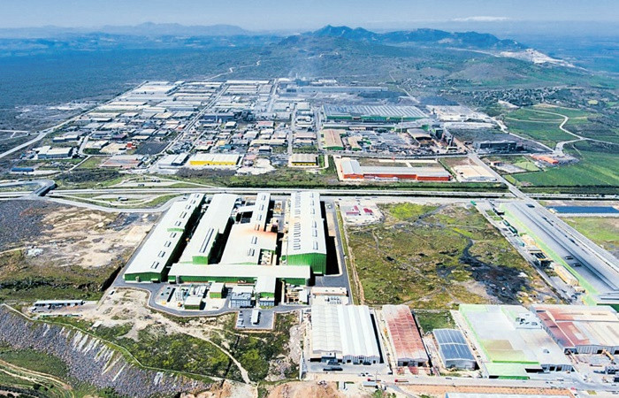
Osmaniye OIZ:Osmaniye Organized Industrial Zone
Osmaniye Organized Industrial Zone, which is the locomotive of Osmaniye Industry, was established in 1994. Industrial Zone, currently covering 699 hectares and employing approximately ten thousand people in 139 plants has been growing and modernizing day by day as the center of attention of domestic and foreign investors with the power of its geographical location, infrastructure facilities and the incentives. In the region, which is a mixed OIZ by structure, there are mainly Iron and Steel Industry enterprises and the number of these enterprises is 47. Textile sector follows it with 24 enterprises.
Electricity, natural gas and wastewater treatment infrastructure required for the enterprises operating in Osmaniye Organized Industrial Zone are completed. A 7.5-Megawatt solar power plant was also implemented to meet the electricity need of the OIZ Directorate in areas outside the facilities.
The Osmaniye Technology Development Zone, which is currently under construction in the OIZ, aims to ensure university-industry cooperation and R&D studies in order to enable existing and new entrepreneurs to head for the value-added production and advanced technology by benefiting from incentives.
Osmaniye Customs Directorate, also located in the region, operates in the Class A status and is authorized for all kinds of import, export, transit and passenger transactions, except for transactions carried out by specialized customs.
OIZ Industrial Zone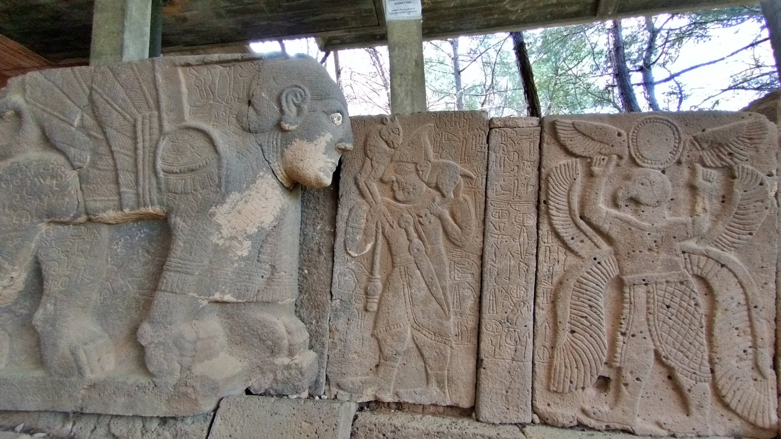
About Osmaniye
Karatepe-Aslantaş Open Air Museum
With its inclusion in the UNESCO World Heritage Tentative List last year providing a boost in promotion, Karatepe Aslantaş Open Air Museum and National Park has been preparing to host local and foreign visitors for the upcoming tourist season following the completion of two new viewing terraces and the installation of ramps for disabled people.
Karatepe Aslantaş Open Air Museum, located within the borders of the Kadirli district of southern Turkey’s Osmaniye province, is one of the most significant open-air museums in Turkey with its historical artifacts dating back to the eighth century B.C.
Recent renovations at the site saw the construction of two new viewing terraces aimed at enhancing the visual experience of guests, and also ramps that should make it easier for people with disabilities to visit the museum and the national park.
Further planned additions include a library and cafeteria which will be built next to the museum.
Meanwhile, the general cleaning and infrastructure work around the Karatepe Aslantaş Open Air Museum and the National Park, have been completed for the most part.
Karatepe-Aslantaş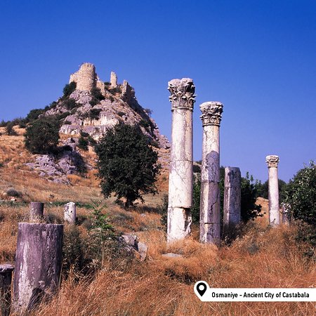
About Osmaniye
Castabala-Hierapolis
Kastabala-Hierapolis, which is one of the important cities of Ancient Cilicia, is located in the middle of Kesurburun, Bahçe and Kazmaca villages. The city is located near the Ceyhan (Pyramos) River, overlooking a small plain. Research to date has shown that the boundaries of the ancient city include the fertile plain extending between the Ceyhan River in the south, Karatepe in the north, and Kırmıtlı in the west. The buildings in the city center, surrounded by a city wall built in the 4th century AD, spread to the northern and eastern slopes of a small valley dominated by the castle hill. Kastabala Hierapolis is the cult center of Artemis-Perasia and the ancient sources mention the existence of this sanctuary. Recent scientific excavations in the city have yielded important scientific data to reveal the existence of the cult center. The city was first seen in the coins of the city, which were minted during the reign of IV. Antiochos Epiphanes, one of the Seleucos Kings. IV. Antiochos gave the name of “HIEROPOLIS”, meaning holy city because of the name of the goddess Artemis Perasia who worshiped for many years in the city. With the permission of the Ministry of Culture and Tourism, as a result of excavations and scientific studies carried out by a team headed by Prof. Dr. Turgut Hacı ZEYREK from Karadeniz Technical University since 2009, It was found that it was inhabited in the Late Neolithic-Early Chalcolithic Age of the Ancient City (5th-1st Century BC)1-6th century AD and the 13-15th century AD. All of the ruins that survived today belong to the Roman Imperial Period. Water was transported to the city from the Karagedik town of Düziçi District by open water channels.